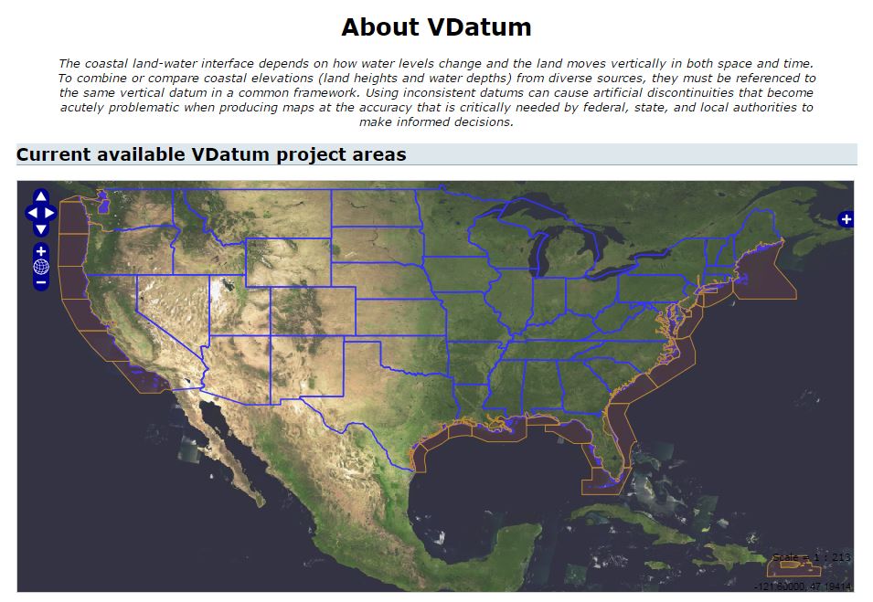
Overview
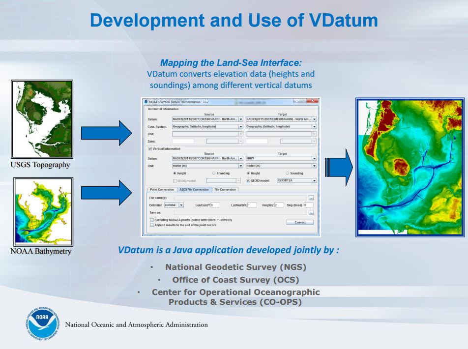
Converts elevation data between tidal, orthometric, and ellipsoidal vertical datums, allowing users to establish a common reference system for all elevation datasets. The conversion tool is based on a hydrodynamic model to convert between tidal and orthometric datums.
Features
- Transform geospatial data between vertical datums using several geoid models
Additional Information
Support
Tool Screenshots