Issue
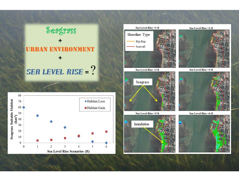
Seagrass provides many essential ecosystem functions, and, like terrestrial plants, it requires sunlight for photosynthesis. As sea level rise increases, limited exposure to sunlight decreases the survival rates of seagrass in deeper waters. Hard stabilization projects used to protect against sea level rise could greatly diminish the shallower, suitable seagrass habitats. On the west coast of Florida just north of Tampa Bay, an assessment to determine the potential impacts of sea level rise on changes in suitable habitat was considered crucial in developing a management plan to sustain the area’s seagrass resources.
Process
To assess the impact of sea level rise, the University of South Florida developed a spatial predictive model to analyze the loss of suitable seagrass habitat. Data from the Sea Level Rise and Coastal Flooding Impacts Viewer were then applied to help the partners analyze the potential gain of habitat due to inundation of the shoreline. Sea level rise scenarios and spatial data for flooding and elevation were used to determine the amount of potential seagrass habitat gain along the highly urbanized shoreline.
Impact
The application of the Sea Level Rise and Coastal Flooding Impacts Viewer data demonstrated the potential impacts on seagrass resources of a hardened shoreline (such as seawalls or riprap) and further shoreline armoring. The tool’s integratation with habitat suitability modeling makes this information essential for an integrated management plan that aids state and local land managers in maintaining the ecosystem and shoreline interests.