Issue
Seagrasses play a critical role in strengthening coastal hazard resilience, healthy habitat, carbon storage, and economic vitality. Project partners analyzing an estuary-wide eelgrass collapse in California’s Morro Bay discovered that erosion took place in more than 90 percent of areas where eelgrass formerly grew. This raised questions about which data and strategies were needed to make future eelgrass restoration areas less vulnerable to erosion.
Process
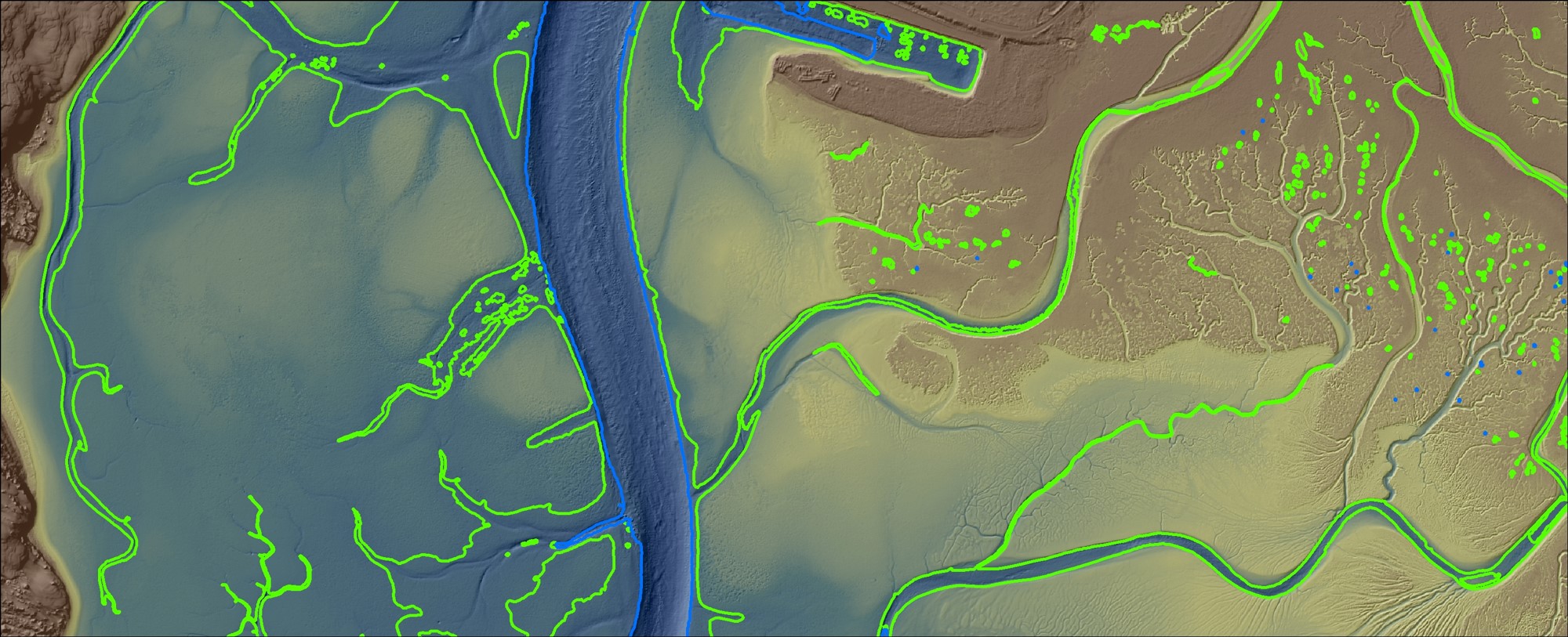
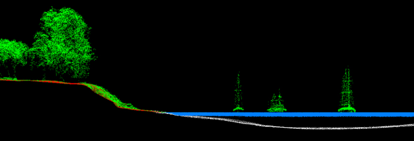
Realizing that eelgrass, tidal marsh, and sand spits can be very sensitive to changes in elevation, the Morro Bay project partners collected seamless data of the area’s land features (topography) and the bay’s submerged features (bathymetry) using water-penetrating lidar from an airplane and ship-based sonar technologies. (Lidar and sonar both create detailed images of the seafloor.) NOAA’s Data Access Viewer was an important tool in the process.
Combining these datasets with recent survey data enabled the team to create a 3D elevation model that showed the seamless topobathy surface of Morro Bay. The data collection process also was used to identify the “void” area where lidar pulses could not reach. This approach allowed the project team to save time and costs by narrowing the focus of their sonar data collection.
A partner installed two water-level monitoring stations, collecting data that updated hydrodynamic circulation models developed more than 20 years ago.
Impact
The Morro Bay partners’ data collection efforts and 3D elevation model will improve bay-wide adaptation efforts by informing future eelgrass conservation and restoration sites, which will strengthen area habitat and resilience in an era of intensifying climate change.
The combination of lidar and sonar data are providing Morro Bay organizations with something new—the ability to pinpoint sites with the optimal depths for transplanting eelgrass. That information is expected to improve eelgrass restoration results. In addition, data collection from the two water-level monitoring stations provided an updated and enhanced understanding of Morro Bay’s hydrodynamics, sedimentation, water quality, and other factors that influence resilience and habitat conditions.
Project efforts were informed by a paper on the relationship between the bay's eelgrass collapse and widespread erosion from the California Polytechnic State University-San Luis Obispo and partners. (2021)