Issue
Recently, the island of Tinian in the Commonwealth of the Northern Mariana Islands has seen an increase in military activity. The renewed activity raises concerns about the 21 historic World War II sites already identified in the vicinity, including several areas that have been hidden from view for decades. Island residents, government agencies, and the Northern Marianas Humanities Council are striving to preserve these sites, promote their national significance, and make them more accessible to the public.
Process
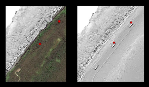
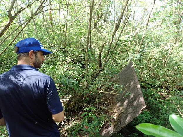
The Northern Marianas Humanities Council worked with Pacific Coastal Research and Planning and the Mayor’s Office of Tinian to formally survey and map all 21 historic sites in order to delineate a precise boundary for a proposed National Historic Landmark. Many of these sites were overgrown and hidden, making them difficult to find or see on a map. For those sites, the partners generated custom hillshade elevation maps using 2020 coastal topographic lidar from NOAA’s Digital Coast. They then matched the elevation maps with historic photographs and aerial imagery from World War II. The features delineated from this comparison guided partners in a machete-assisted field survey to ensure that the proposed historic landmark boundaries included the correct areas and historic features.
Impact
This work resulted in a detailed boundary for the proposed National Historic Landmark that included coordinates for all the historic sites. The proposed landmark is under review by the National Park Service for formal adoption and incorporation in the National Register of Historic Places. You can explore the sites virtually within this story map. (2023)