Issue
The Houston area provides important habitat for migratory birds along the Gulf of Mexico coast. But with growing human populations over the past few decades, many natural areas such as forests, wetlands, and coastal prairies have been developed. In addition, many bird habitats are increasingly at risk from sea level rise and more intense tropical storms. Habitat protection is an essential element for bird conservation, and high-quality data are critical to effective conservation decision-making.
Process
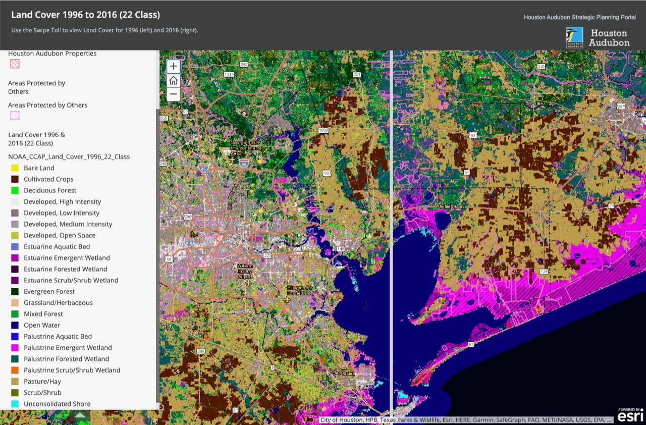
To help area managers make better-informed decisions, the Houston Advanced Research Center partnered with Houston Audubon to develop a series of online maps. The maps include sea level rise, marsh migration, and C-CAP land cover data from NOAA’s Digital Coast to help managers visualize changes and trends in development, as well as natural areas that could be affected by future sea level rise. These maps are part of a portal that supports guiding principles for land conservation, which were developed as part of Houston Audubon's Strategic Planning Initiative. The portal serves as a tool for Houston Audubon board members, committees, and business partners to easily access relevant information.
Impact
Visualizing these changes helps managers identify current protected habitats that are at risk, and find new areas to help protect. The online mapping interface provides a user-friendly vehicle for conservation experts working with Houston Audubon to view data and collaborate more efficiently with Houston Advanced Research Center. In particular, the land cover, sea level rise, and marsh migration data allow decision makers to
- Focus on habitats of greatest conservation need, with benefits to diverse avian species
- Identify lands that provide the greatest connectivity to other conservation lands
- Evaluate land conditions with the highest integrity
- Identify lands that have the greatest opportunities, best access, and least vulnerability to climate change issues
- Evaluate past, current, and future land cover changes that pose the least threat of risks from development
In addition, the mapping interface allows for easier and more efficient updates when new data become available. (2021)