Issue
Communities in South Florida are exposed to numerous coastal flood hazards. Understanding these risks and potential impacts is complex and involves thinking not only about coastal flood hazards, such as storm surge flooding, high tides, and precipitation, but also how sea level rise will exacerbate impacts. Conveying these risks to residents in an understandable way can be challenging, but is critical in spurring action to reduce future impacts.
Process
To help communicate the realities of coastal flooding and climate risks to residents throughout South Florida, Miami-Dade County’s Office of Resilience uses NOAA’s Coastal Flood Exposure Mapper to familiarize them with coastal flood hazards in specific communities. Maps generated by the tool are added to presentations given during public meetings that are offered to help residents understand their coastal flooding risks.
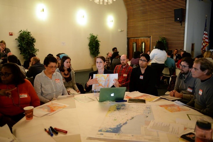
One instance of these maps being used was during an Anti-Poverty Summit, at which community members from low- to moderate-income households were brought together to discuss how their community may be at risk. Maps from the Coastal Flood Exposure Mapper were printed and placed on tables to generate conversation among residents from different neighborhoods.
Impact
Through these conversations, community members who are not typically part of the discussion were made more aware of the flooding risks that exist beyond just the shoreline and waterfront. Maps prompted discussions about these risks and how residents can increase resilience to impacts in their communities. (2018)