Issue
West Maui’s coastal waters serve as home to living coral reefs and support a hospitality industry built on nearshore amenities. Muddy waters from terrestrial runoff threaten the health of this delicate ecosystem and the local economy. Since new onshore developments may further impair nearshore waters, mitigating the source of sediment-polluted runoff needed to be considered during planning efforts.
Process
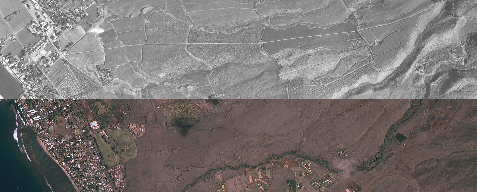
Conventional soil erosion models identified former agricultural fields as the sources of sedimentation. However, an examination of historical imagery clearly showed that extensive debris piles from past land clearing for agricultural, and not the fields themselves, were the sources of fine sediment accumulation in valley bottoms.
Impact
The examination of Pacific Historic Aerial Imagery from NOAA’s Office for Coastal Management, along with geomorphic mapping and field observations from the U.S. Geological Survey, indicates that conditions caused by past land use practices contributed to West Maui’s current issues. This new analysis has shown that conventional soil erosion models, which focused on the former agricultural fields, were incorrect. Plans can now be put in place to address sedimentation at the source.