NOAA Strengthens Resilience Before, During, and After Disasters
The Takeaway: NOAA initiatives and state partnership programs are making a difference throughout the nation’s coastal zone.
“Stressful” is the word that likely comes to mind when describing the years 2020 and 2021—and not just because of the pandemic. These years saw 42 weather and climate disasters, causing damages or costs that reached or exceeded one billion dollars each. Other devastating impacts included loss of life and severe harm to habitat. Despite these unsettling realities, the future offers great hope. Disaster-resilience projects and public interest are climbing fast, with help from NOAA and partners.
Balancing ecology and economy
- The National Coastal Resilience Fund began in 2018 and has awarded more than $135 million to 174 projects that restore or expand marshes and wetlands, shorelines, oyster and coral reefs, barrier islands, and other nature-based systems. NOAA and the National Fish and Wildlife Foundation lead the effort.
- The 2021 U.S. Infrastructure Investment and Jobs Act contains $2.96 billion in NOAA investments over five years to build infrastructure that is climate ready and climate resilient. This includes $207 million for habitat restoration through the National Coastal Zone Management Program, $77 million for restoration projects in the National Estuarine Research Reserve System, and $492 million for National Coastal Resilience Fund grants, led by NOAA and the National Fish and Wildlife Foundation.
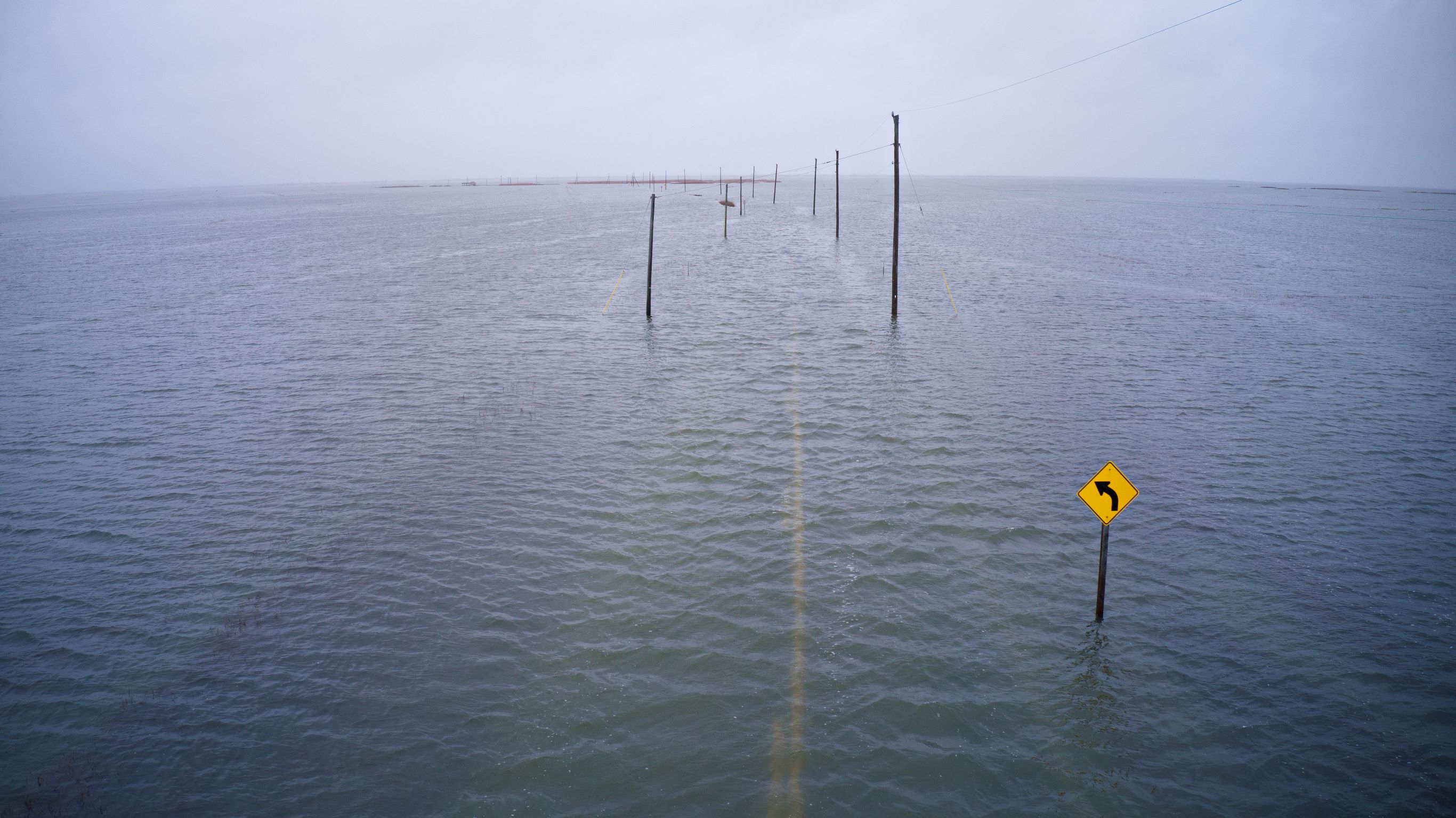
- New sea level rise projections were published in 2022 to tremendous media coverage, even in business publications such as Fast Company. The jump in use of related tools further shows the message is being heard. Traffic to the Sea Level Rise Viewer climbed nearly 3,000 percent immediately after new projections were published, and traffic to Coastal County Snapshots saw a 13,000 percent rise during the same period. (The snapshots show each coastal county’s percentage of at-risk people, homes, and businesses.)
The state partnership programs that operate through NOAA’s National Coastal Zone Management Program, National Estuarine Research Reserve System, and Digital Coast offer additional approaches for increasing the resilience of coastal communities. Examples from 2020 and 2021 are provided below.
Resilience planning initiatives
- In California: The Adaptation Roadmap guides communities that have completed a sea level rise vulnerability assessment and are now embarking on an equitable adaptation plan that includes both local context and in-depth analyses. The San Francisco Bay Conservation and Development Commission led its development, assisted by an advisory board.
- In Delaware: The state’s coastal zone management program helped develop the Delaware Climate Action Plan and public-private leaders have embraced it, proposing initiatives that include more all-electric vehicles in public transportation and dramatically increased electric vehicle charging stations and sales targets.
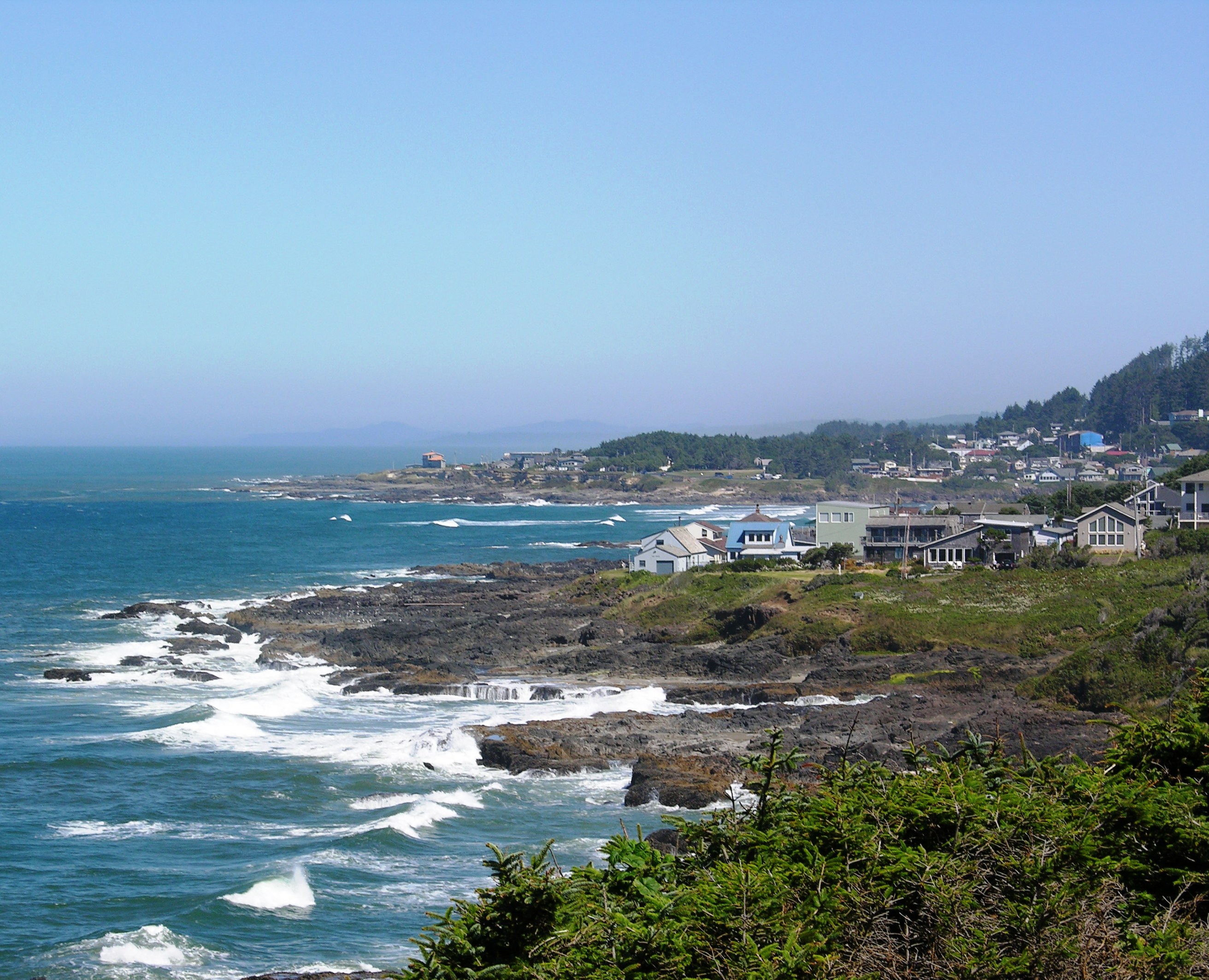
- In Oregon: New “disaster cache” guidance can boost the likelihood of survival and safety in coastal communities immediately following tsunamis or earthquakes. Several state agencies and the NOAA National Tsunami Hazard Mitigation Program supported the effort. Ten jurisdictions already have incorporated tsunami considerations into land-use plans, aided by the Oregon Coastal Management Program.
- In the Southeast and Caribbean: NOAA’s Southeast and Caribbean Regional Team aided a new guide that is improving disaster-management communication and coordination among NOAA offices and partners.
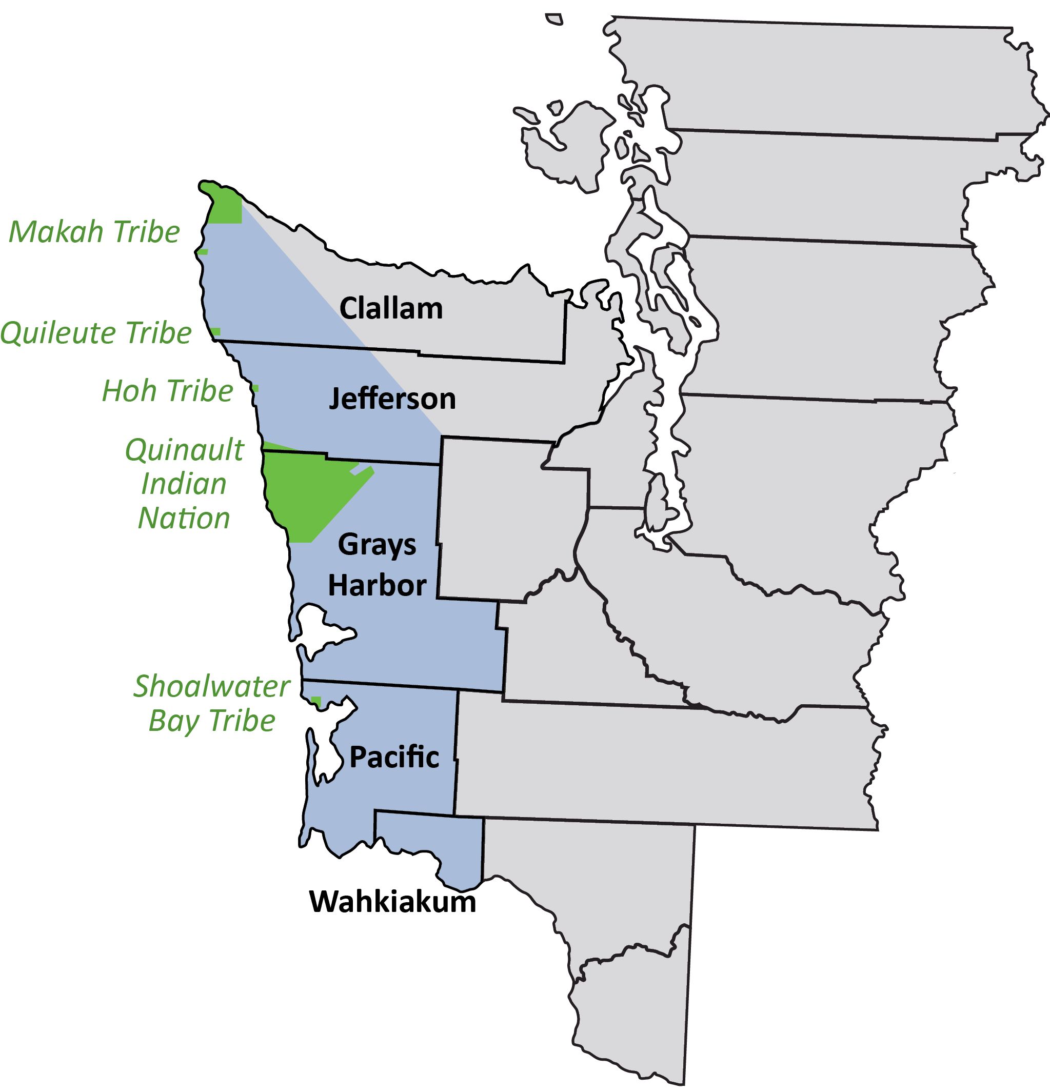
- In Washington State: The Washington Coastal Zone Management Program helped roll out a comprehensive climate resilience plan, and in 2022 a NOAA-funded report is helping rural and tribal coastal communities to explore more than 175 state projects that could boost their own adaptation capacity.
- Across the research reserves: All 30 research reserve sites are on their way to greater resilience. Twelve sites completed disaster plans and nine have gone through disaster-focused exercises. Also, 11 newly purchased satellite phones (which do not rely on local electric grids) enable communication in the aftermath of disasters. NOAA’s Office of Response and Restoration provided $144,000 to advance the reserves’ disaster resilience.
Disaster response
- In Alaska: When a fatality was connected to paralytic shellfish poisoning, the Kachemak Bay Reserve assisted safety outreach efforts as well as a public service announcement released by state officials.
- In Oregon: South Slough Reserve staff members provided water transportation for firefighters needing access to remote forest fires.
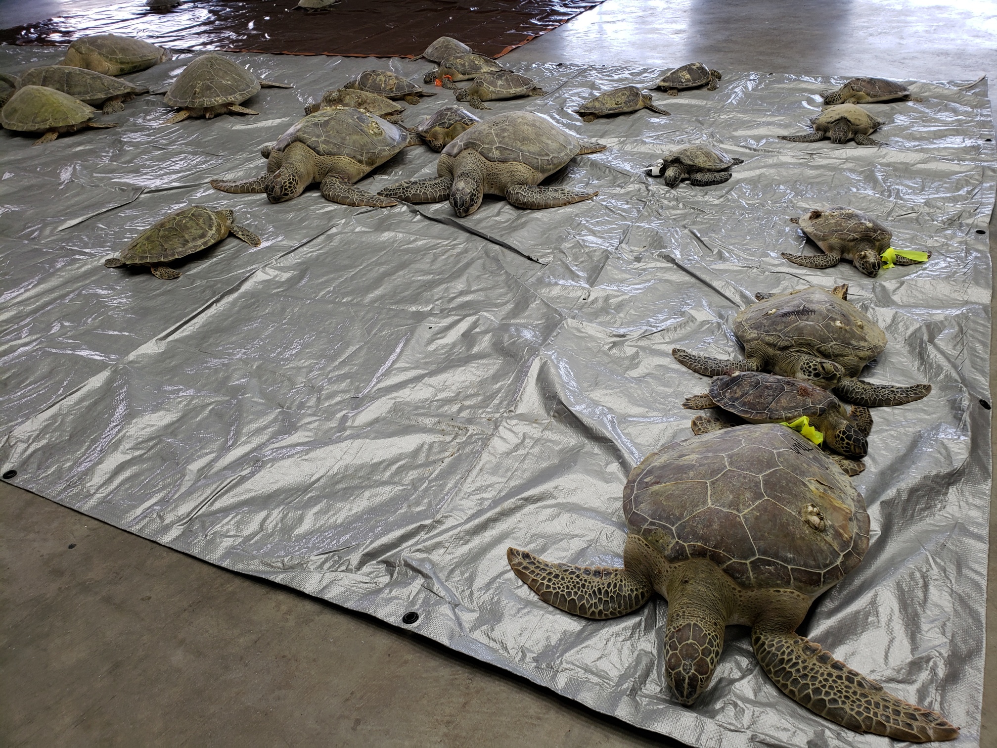
- In Texas: More than 1,000 cold-stunned sea turtles were rescued and treated, thanks to quick mobilization by Mission-Aransas Reserve staff members and volunteers.
- In Wisconsin: The Lake Superior Reserve collected data during and after a 2018 explosion and series of fires at a refinery, and staff members continue to document lingering impacts. Reserve data are informing development of a new state standard for chemicals used in firefighting.
Building resilience stronger than before
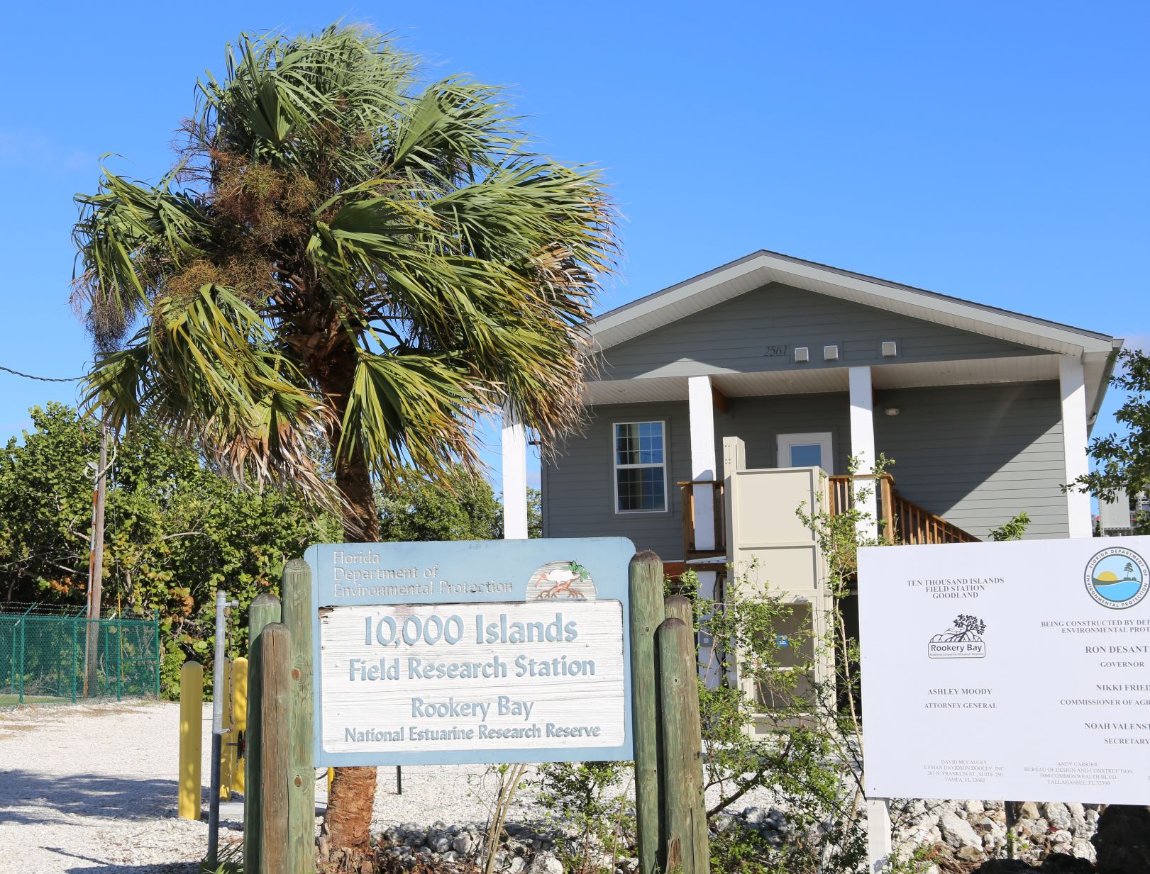
- In Florida: A storm-damaged research field lab and bunkhouse at Florida’s Rookery Bay Reserve was replaced by a new field station designed to exceed federal flood standards. Also, this reserve continued post-Irma recovery by contributing $80,000 and staff time to Collier County, for debris cleanups in hard-to-reach mangroves and waterways.
- In Florida and North Carolina: The Apalachicola Reserve and North Carolina Reserve received a combined $56,000 in NOAA supplemental funding to support continued recovery from recent hurricanes.
- In Georgia: The Sapelo Island Reserve is supporting the monitoring, removal, and recovery efforts for the capsized MV Golden Ray, a 660-foot-long car carrier that capsized in 2019. This includes monitoring for dangerous fuels.
- In Puerto Rico: In the years since 2017’s Hurricane Maria caused island-wide damage to utilities, the Jobos Bay Reserve provided off-the-grid power backup by connecting integrated batteries to solar panels on its dormitory roof. This innovation makes critical services available to the community during power outages.
Investing in disaster resilience brings a host of benefits—find out more here. (2022)
Partners: AECOM; AT&T, Accessible Climate Strategies; Amos Rehabilitation Keep, Adapting to Rising Tides; Bay Area Regional Collaborative; California Office of Planning and Research; City of Florence, City of Gearhart, City of Newport, City of North Bend, City of Port Orford, City of Reedsport, and City of Rockaway Beach, Oregon; City of Tacoma, Washington; Coos County; County of Santa Clara Office of Sustainability; Douglas County; Delaware Department of Natural Resources and Environmental Control’s Air Quality and Climate, Coastal, and Energy Divisions; Federal Emergency Management Agency; Greenlining Institute; Island County; King County; Lynker; Marin County Department of Public Works; Metro Parks Tacoma; National Estuarine Research Reserve Association; National Fish and Wildlife Foundation; NOAA’s Digital Coast, National Coastal Zone Management Program, National Tsunami Hazard Mitigation Program, Office for Coastal Management, and Office of Response and Restoration; Occidental; Oregon Coastal Management Program and Department of Geology and Mineral Industries; Pacific Northwest Climate Impacts Research Consortium; Apalachicola Bay, Jobos Bay, Kachemak Bay, Lake Superior, Mission-Aransas, North Carolina, Padilla Bay, Rookery Bay, Sapelo Island, and South Slough Research Reserves; Port Aransas Fisherman’s Wharf; San Francisco Bay Conservation and Development Commission; San Francisco Estuary Institute; Shell; The Nature Conservancy; Tillamook County; TransRe; U.S. Army Corps of Engineers; U.S. Environmental Protection Agency; U.S. Department of Defense; U.S. Geological Survey; University of Oregon; University of Texas Marine Science Institute; University of Washington’s Climate Impacts Group, College of the Environment, Department of Earth and Space Sciences, Department of Marketing and Communications, and School of Marine and Environmental Affairs; Washington State Department of Ecology’s Coastal Zone Management Program and Department of Fish and Wildlife.
PRINT