Expanding the Network of Protected Lands along South Carolina’s Black River
The Takeaway: Bipartisan Infrastructure Law funding will expand South Carolina’s Black River land conservation effort and protect 1,800 acres of floodplain for enhanced flood protection, water quality, wildlife habitat, and recreational opportunities.
A $4,500,000 grant from the Bipartisan Infrastructure Law was used to acquire 1,800 acres of land in a key floodplain, permanently conserving and preventing development of more than 575 acres of mature forested wetlands and 1,225 acres of pine woodlands in South Carolina’s Williamsburg and Georgetown counties.
The South Carolina Coastal Zone Management Program, working with additional partners, helped acquire this money through NOAA’s Coastal Zone Management Habitat Protection and Restoration Awards.
The project contributes to a larger land preservation initiative (70 miles and more than 24,520 acres) that established the new Black River State Park. For this historically underserved area, the effort is protecting communities from flooding, all the while expanding access to public lands, boosting local economies, and providing recreational opportunities that include paddling, hiking, biking, and fishing.
“With the Bipartisan Infrastructure Law funding, we had the opportunity to build on the great work these partners and communities have already done to conserve the historic Black River for future generations,” said Dr. Jeff Payne, director of NOAA’s Office for Coastal Management.
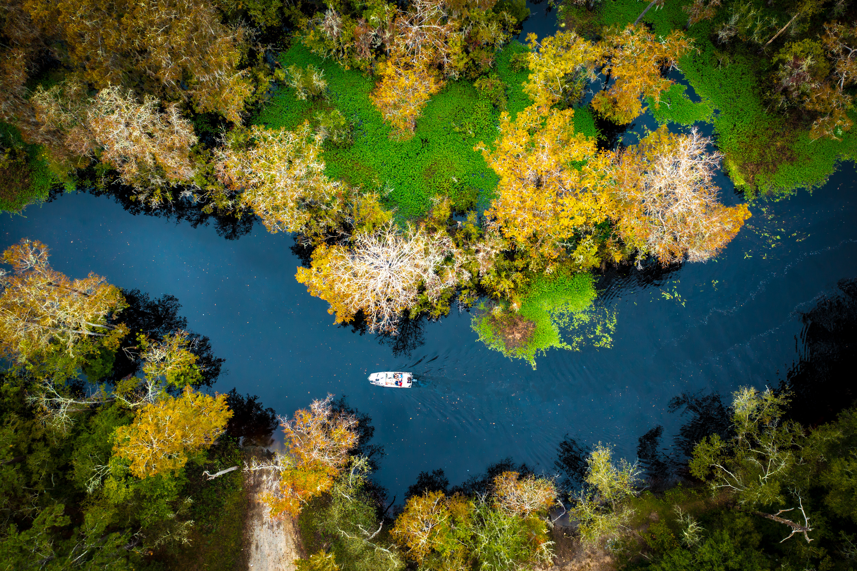
Winding through South Carolina’s coastal plain for 151 miles, the Black River supports unique ecosystems including many rare plant and animal species. The Black River has experienced increased rainfall and flooding in recent years, worsened by climate change. Protecting the floodplain forests along the river will provide a natural buffer to floodwaters, helping mitigate the impact to riverside communities.
A push from the community to protect this critical floodplain ecosystem led South Carolina to establish its first new state park in nearly 20 years. Coordination on these conservation efforts began in 2020 through a public-private partnership to develop a new vision for the Black River corridor, focused on providing equitable access to recreation, encouraging ecotourism, and maintaining flood-absorbing natural lands.
Community members drove the planning process, sharing their connections with the river and their priorities for the proposed water trail and park network. For the rural towns along its route, like Andrews and Kingstree, the Black River initiative will provide a connection to nature, promote economic opportunity, and preserve the history of the Black River for generations to come.
Federal Funding: $4,500,000
Partners: NOAA; South Carolina Department of Health and Environmental Control; Open Space Institute Land Trust; South Carolina Department of Parks, Recreation, and Tourism; The South Carolina Conservation Bank; and South Carolina Office of Resilience
PRINT