
The Takeaway: See how a community engagement approach is helping this village restore the natural floodplain and reduce flooding impacts.
Overview
The approach used by Delaware County, New York, allowed all interested community members to participate in decisions about floodplain restoration and flood reduction. Graydon Dutcher, with the Delaware County Soil and Water Conservation District, led municipal leaders and stakeholders from Walton through the modeling process and potential floodplain restoration scenarios.
Lessons Learned
- Form a flood commission for the municipalities. The county’s soil and water conservation district leaders saw that the municipalities surrounding and impacted by the Delaware River were disjointed when it came to addressing flooding issues. These leaders knew their priorities would overlap at some point, and in order to get funding, coordination was needed. They decided the formation of a flood commission would be the right approach.
- Include every stakeholder potentially impacted by flooding in the flood commission up front. The commission realized it needed to include stakeholders in any modeling and restoration efforts to gain support and maximize benefits. Members also realized the need to be sensitive when talking about specific properties that would benefit from restoration projects.
- Tackle smaller flood issues first. Starting with small efforts and increasing to larger ones is a good way to see immediate successes, gain support for additional projects, and keep community members from getting frustrated by lack of progress once they are committed to large-scale solutions.
- Highlight the environmental benefits of floodplain and restoration projects in addition to the safety and economic benefits. People don’t always focus on the environmental benefits, but they do value them.
- Provide flood impact information and mitigation opportunities before the next disaster. This helps communities respond in a way that reduces future flood impacts rather than having to rebuild in the same spot and in the same way.
The Process
Understanding the Local Flooding Issue
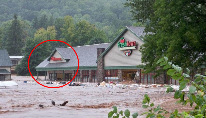
Over the last 20 years, Delaware County, New York, has experienced major flooding and increased flood damage along the Delaware River from intensified storms. The impacts on the county’s municipalities are severe because of the filling of the river’s floodplain, causing flooding to homes, farms, and businesses.
“Many people forget that the floodplain is part of the river, where the river overflows during periods of high flow,” says Graydon Dutcher, Delaware County Soil and Water Conservation District’s stream program coordinator. “Because of the way we have built our communities in and around the river and floodplain, we have put ourselves in harm’s way, and need to rethink how and where we build in the future to lessen impacts to our homes, businesses, and farms.”
It wasn’t until after Tropical Storm Irene in 2011, however, that the county’s conservation district and its partners decided to model potential flood impacts and think about ways to reduce them. “The only way we were going to break the cycle of redeveloping in the same areas that continuously flood was to create information that showed people where flooding happens, the impacts, and what different flood mitigation projects could help. This would give community members scientifically based information that they helped create to inform their decisions,” Graydon states.
The district started looking at the natural floodplain footprint, the flooding issues, and the elevation of Main Street and Water Street in Walton, which had been flooding. They wondered what would happen if they reclaimed the floodplain, since this is naturally where rivers overflow.
Stakeholder Approach to Modeling Flood Scenarios and Mitigation Techniques
The Delaware County conservation district started the Walton Flood Commission to bring together municipal leaders and stakeholders to discuss flooding issues and mitigation opportunities. The commission is made up of 25 people from Walton and various New York state government offices.
The flood commission requested that the Delaware County conservation district hire a consultant to model a variety of flood scenarios and past storm events. The consultant modeled storms and historical storms ranging from two to 500 years. The district first presented higher probability storms (five-year storm and 20-percent annual chance storm) to the commission and used flood models to explore different techniques, ranging from floodplain restoration to bridge replacements, to decrease impacts.
Then the district presented a lower probability but higher intensity storm scenario (100-year and one-percent annual chance storm), and explored additional possibilities for mitigation techniques for this level of flooding. This approach allowed all ideas to be seen and heard and helped prevent discouragement along the way.
Engaging Community Members
The district and flood commission held public meetings to hear input from anyone who could be impacted during flood events. During these meetings, they talked with community members about how streams work and demonstrated what a reclaimed floodplain looks like, showing how these restoration efforts would not damage property or devalue businesses.
Once community members started seeing potential results from different floodplain restoration projects, they decided it was time to take action.
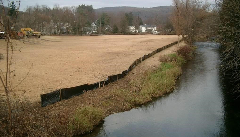
West Brook Site Restoration
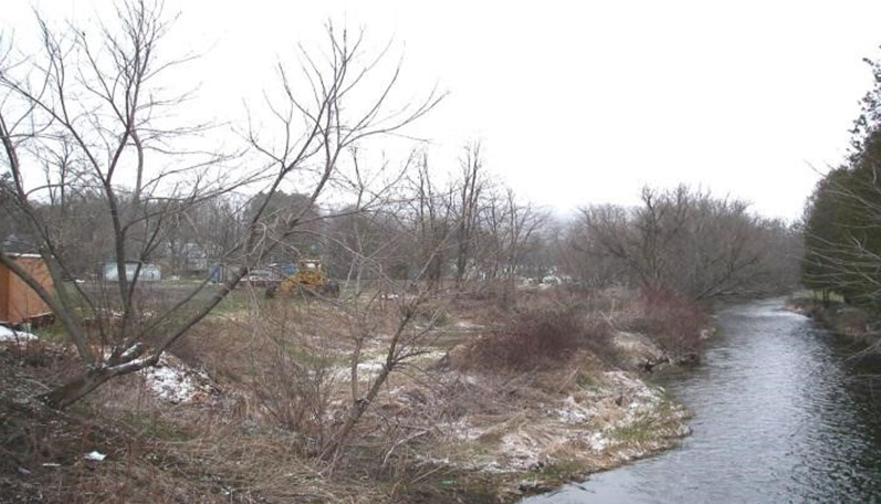
When Walton experienced a major flood in June 2006, the river overtopped its banks and water flowed freely through the village. A floodplain on the right bank, filled in and therefore unable to provide flood storage during the event, became known as the West Brook site. The restoration project aimed to reclaim the floodplain by removing fill and grading it to the right elevation and slope to allow water to spread out over the area, instead of overtopping the banks and impacting nearby businesses. The county district worked closely with the Village of Walton, the Open Space Institute, and New York City Department of Environmental Protection to acquire, design, and restore the area.
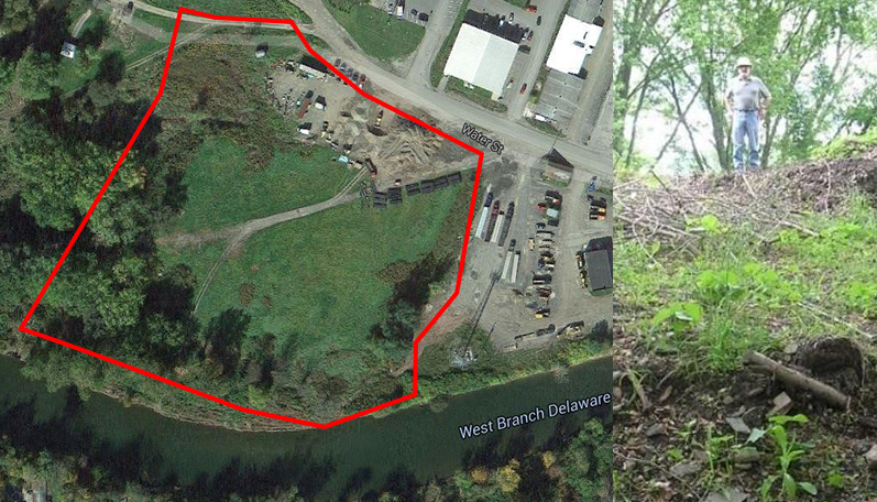
Water Street Site Restoration
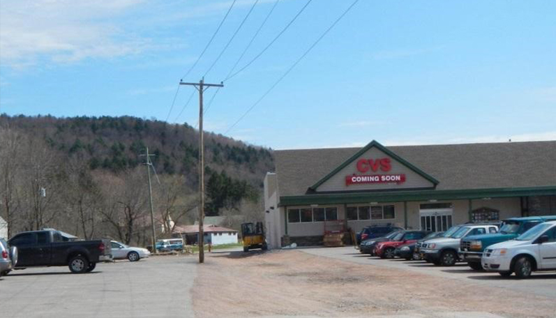
Once people started seeing success at the West Brook site, they decided to move forward on the Water Street site, which is owned by the Village of Walton. There, the fill sits at a higher elevation than Delaware Street, causing stormwater runoff and pollution to concentrate on this street. There is no vegetation filtering the water before it runs into the west branch of the Delaware River, which supplies water to New York City’s Cannonsville Reservoir. The restoration project will remove the fill and correct the grading and filtration issues. The project, which will cover 2.8 acres, is in the design and permitting phase and will cost $625,000.
The long-term plan is to connect the project sites to further increase the flood reduction benefits.
Outcome
The Delaware County Soil and Water Conservation District and the Walton Flood Commission continue to implement opportunities prioritized in the local flood hazard mitigation plan and are seeing flooding reduced with each project. Community members are also seeing the results and are excited about continuing the work.
Thanks to the restoration project, not only are homeowners and businesses experiencing fewer flooding impacts, they are also saving money. The community will begin saving 10 percent on flood insurance policies, since the restoration project allowed the community to become a Class 8 in the Federal Emergency Management Agency’s Community Rating System program. And with the new restoration efforts, flood levels could significantly change, prompting an update in FEMA floodplain maps. This could lower insurance rates further and could even remove some homes and businesses from the floodplain entirely.
Next Steps
The Village of Walton is continuing to look at additional projects to implement on the West Brook site, since it is the largest drainage area. Lowering flood levels here should lower flood levels on the other three tributaries.
Work on the Water Street project continues and includes feasibility studies for relocating businesses, acquiring land, demolishing buildings, and conducting soil tests. They are restoring native vegetation and removing invasive species, correcting the elevation and slope of the floodplain, creating a riparian buffer, and restoring wetlands where possible.